This script provides R code to visualize GPS data using geotagged pictures.
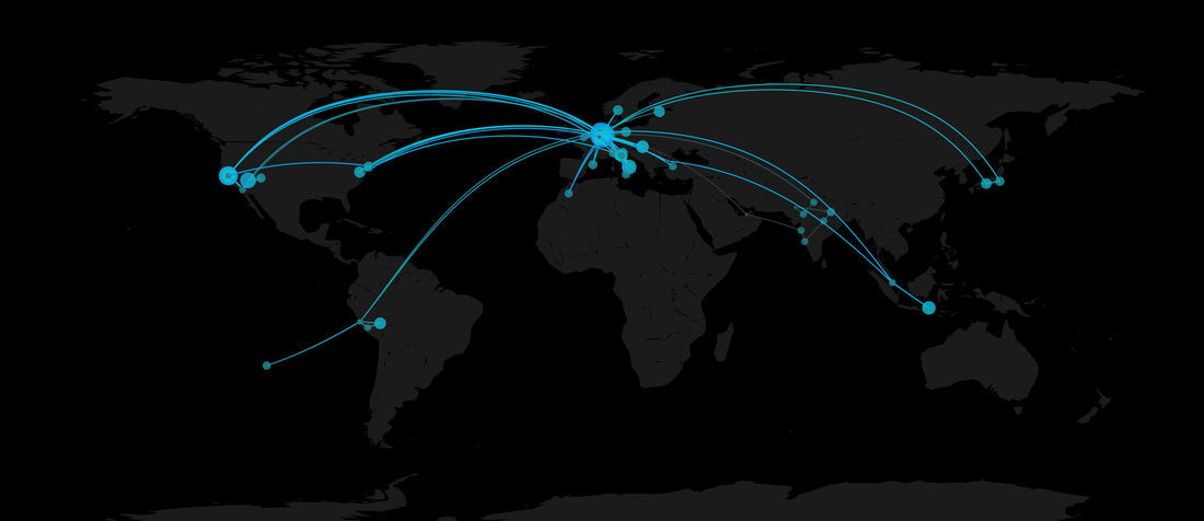
Most pictures taken using a mobile phone get automatically geotagged. This script extracts metadata from JPEG files, including latitude, longitude and date when the picture was taken, and plots great circles between locations farther than a configurable threshold. Additionally, time spent in different locations is shown using circles of different sizes.
Parts of the script are based on code from flowing data / Nathan Yau (http://flowingdata.com/2011/05/05/where-do-major-airlines-fly-in-the-united-states/) and timelyportfolio (http://timelyportfolio.github.io/rCharts_catcorrjs/exif/)
Usage:
- download and install exiftool, which is called by the R script (http://www.sno.phy.queensu.ca/~phil/exiftool/)
- download your pics from your mobile phone (I used Dropbox Camera Upload)
- set the path to your pics folder in the R script
- run the script
The map will be exported as a pdf in the same folder you set as path.
Find out more here: http://www.marcoaltini.com/blog/map-your-trips-using-pics-from-your-phone-code
Examples:
